Showing posts with label Drone. Show all posts

Wednesday, March 28, 2018

Biking through Little Big Econ SF (and flying along the river)

I started this trip at the equestrian trailhead on Snow Hill Rd. and road my bike through a neighborhood just south of there  to the hunter’s entrance to the state forest.  There are “no parking” signs all over the neighborhood, so they’ve essentially made this their own private trailhead.

Two Ponies-3
Ponies grazing in the shade

CorralAlong the way through the state forest property, this path goes through five gates that are used to control livestock.  There are a few domesticated horses and ponies back here, so the general rule of leaving the gates as they are (open or closed) after passing through them does apply.Wooden Bridge

There are a few other remnants of the ranch that used to occupy this state land.  A couple of the more interesting structures are a corral and an old wood and metal bridge.  The bridge is still maintained since the forest roads are still used.

The overall distance from the trailhead to the camping shelter is about 4.5 miles; it’s an easy hike or bike ride.  There were only a couple of very small patches of sugar sand that I had to walk my bike through.

River View-1
River View
Camping Shelter
Camping Shelter
River View-2
River View

There are a couple of picnic tables by the camping shelter, as well as a fire ring.  This is the spot where I stopped to do some filming of the river.  Take a look – I think it came out pretty good.

I also had my GoPro filming the trip on the way out.  If you would like to get a feel for what the area looks like, this shows the forest roads leading all the way out.

The map below shows the locations of the major landmarks along the way.  Clicking on the “Wikiloc” icon on the map will take you to the page with more map details.


Powered by Wikiloc

Equestrian Trailhead
Historic Marker-1
Historic Marker (Side 1)
Historic Marker-2
Historic Marker (Side 2)

Sunday, March 04, 2018

Biking CBSF–Heifer Mound

I took a short ride through Charles Bronson State Forest to capture some aerial video around Heifer Mound and Saddle Mound.  These are two of the largest native American shell middens in the immediate area of the state forest (that I’ve seen), and this spot offers some great views of the St. Johns River

mound
Saddle Mound

Parking for this trailhead is at the Chuluota Wilderness area about two tenths of a mile west of the entrance to the state forest.  From here it is a short ride to the windmill – overall it is almost exactly four miles out to the river.

CBSF Entrance
Park Entrance

cbsf sign
Information Kiosk

There are a a lot of these prehistoric sites throughout Florida, and many along the St. Johns River.  For the most part, they are easy to miss, but some of them really stand out.  Heifer Mound is a well known spot by boaters (especially air boats) as a spot to park and enjoy the views.  There is a flag pole on the center of the mound that sometimes has a flag, but I learned  that the flag is frequently taken by vandals.

boats
Airboats on Heifer Mound

I learned that Heifer Mound is known locally as bullshit mound.  I don’t know if it is because people meet here to sit and talk, or (more likely) because cows from a local ranch have been known to hang out here since it offers dry  ground when the flood plane is underwater.

CBSF-1
Charles Bronson SF
SJR-1
St. Johns River 
Gator-2 Alligator Sunning

There used to be a lot of cattle in this portion of the forest, but I there is no sign of them now.  I found out that the rancher no longer has a lease with the state to let his cattle graze here.  The video that I captured while I was here came out pretty good.  I managed to capture some boats out on the river and also the airboats coming out of the river up onto the mound.

Powered by Wikiloc

Friday, January 26, 2018

Biking Charles Bronson SF–Windmill Trip

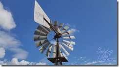
This is a short ride through Charles Bronson State Forest where I stopped to make a little video of the windmill out there.

Windmill Full.jpg
Aeromotor WIndmill – Model 702

The windmill was made sometime before 1964, when the Aeromotor company moved from Chicago to Broken Arrow, OK.  Since then there have been several hurricanes and tropical storms that have either passed through the area, or passed close enough where this old guy saw some pretty strong winds.  Yet here it is, still running and pumping water like it did more than half a century ago.

I started the trip at the parking area for Chuluota Wilderness Area, which is only about a quarter of a mile from the entrance to the state forest.  The entrance was easy with my bike, there is a simple swinging gate so I didn’t need to lift my bike over the fence.

Entrance
Entrance
Road-1
Forest Road
Windmill Top
Windmill Top

The ride out here is pretty easy; the roads are mostly hard packed or grassy, but I don’t think a hybrid bike would do very well because there are some spots with sugar sand.  My mountain bike handled these spots with no problems, but thinner tires would definitely not ride as well.

Gate
One of many gates
 CBSF Sign

I was surprised that I didn’t see any cattle on this trip, and also that much of the farming equipment that I saw on my last trip was also gone.  I don’t know if the forest service has stopped allowing cattle to graze here, or if the ranchers have simply brought the herds somewhere else.  I’ll probably know more in another week or two; I’m planning to come out again soon to visit some of the shell middens.

Powered by Wikiloc